 Five Design Concepts for How to Save the Tidal Basin from Flooding
✉️ Want to forward this article? Click here.
Although the National Mall is no stranger to flooding, the Tidal Basin is becoming increasingly endangered, regularly flooding twice a day. The Save the Tidal Basin's Ideas Lab convened some landscape architects for an exhibition of possible design solutions that adapt to these worsening conditions.
Below, we take a look at those concepts:
story continues below
loading...story continues above

"History Secured"
DLANDstudio's concept explores the idea of crossing water to travel between "island memorials". The proposal would erect a land bridge between the White House and the Jefferson Memorial, let sediment accumulate to create tidal flats, and create a wetlands that would "absorb rising waters".
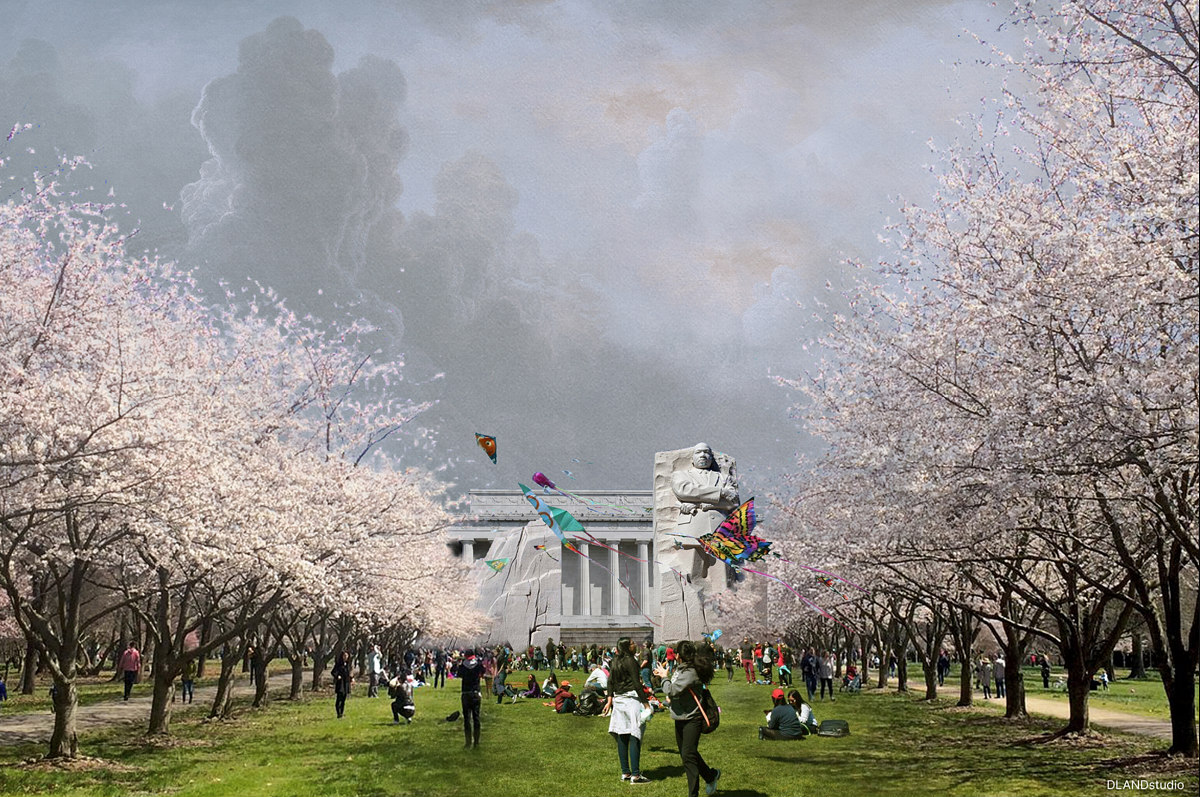
The land bridge would have a meadow at the base of the stairs to the Jefferson Memorial with new cherry trees along either side. A jetty would be added in the Potomac River off the Lincoln Memorial and would serve as a new home for a relocated Martin Luther King, Jr. (MLK) Memorial.
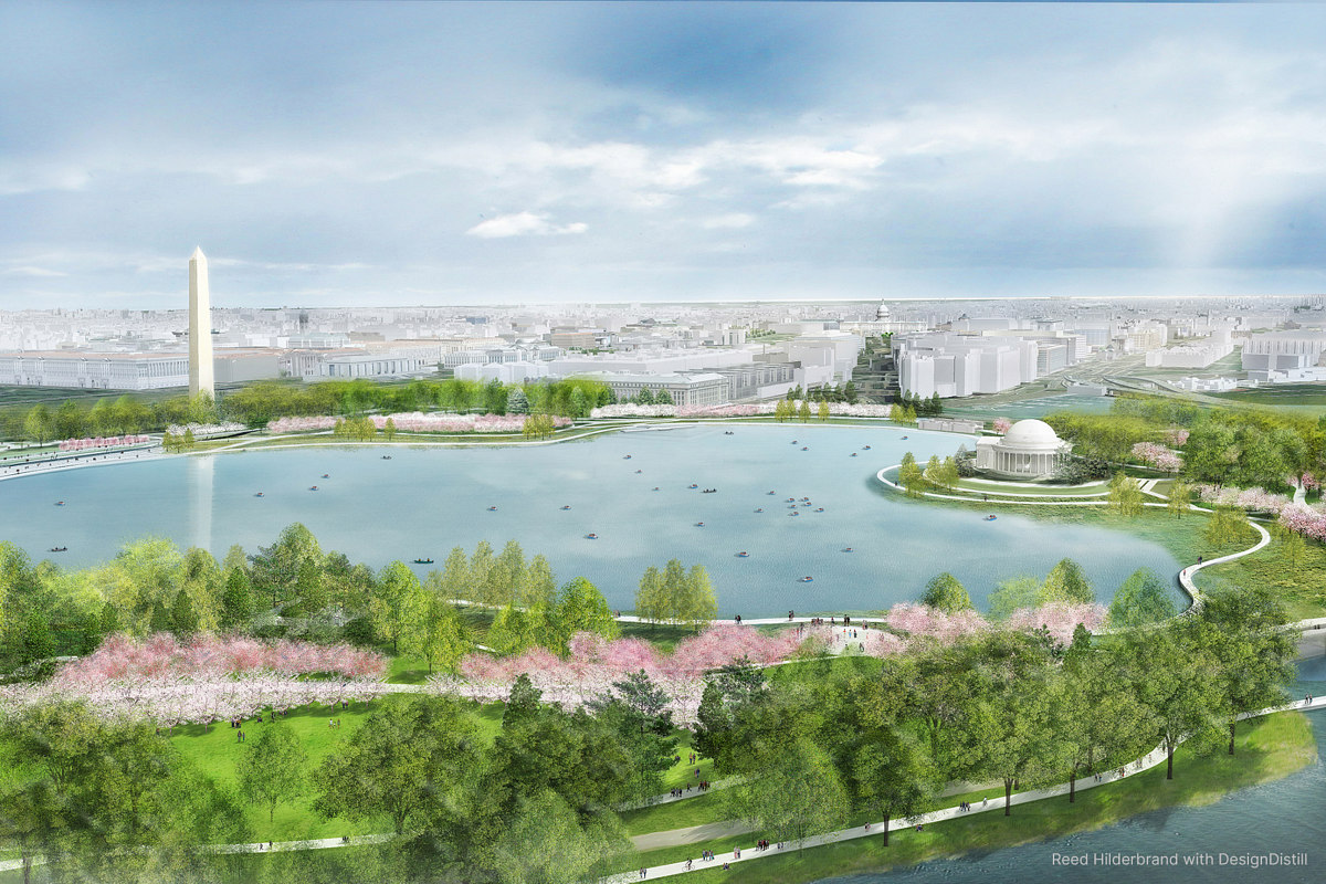
"Open Work"
Reed Hilderbrand's concept reenvisions the Tidal Basin as a "Washington Common" for DC residents, so named as a nod to the Senate Park Commission's recommendation in a 1902 report, connecting public recreational space to the Monumental core.
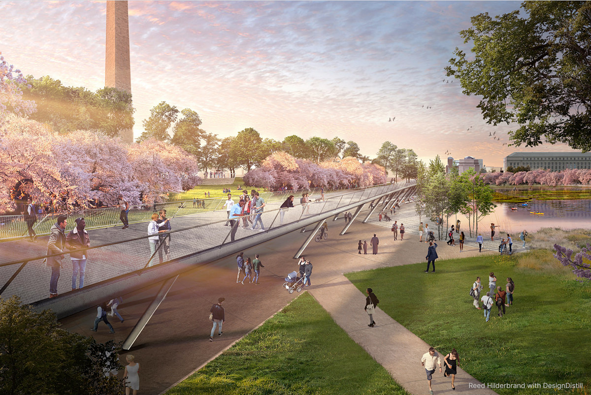
A "Cherry Walk", "Marsh Walk" (with terraced steps for tide-watching), and "Memorial Walk" would converge at a pedestrian bridge ("Independence Rise"). There would also be a "Capitol Overlook" platform accessible from paths around the Tidal Basin. The proposal is meant to be adaptable over 100 years and would accommodate occasional flooding of certain areas.

"A New Cultural Aesthetic"
GGN's concept is envisioned as taking place incrementally in three stages through 2090, over which time the firm states sea levels will rise from 3 to 12 feet. The proposal involves "earthwork" to shore up flood protection for the city, raising the contour to 18 feet starting along the banks of the Potomac and adding a "flood-plain forest" at East Potomac Park in the first phase. The floodgates would also be repaired and freshwater marshland would be added to restore ecological balance to the site.
In the second phase, a three-foot-tall wall would be built to protect the Franklin Delano Roosevelt Memorial, and the MLK Memorial would be relocated out of the floodplain. There would also be "wind gap meadows" with winding paths lined with native flowering trees and some cherry trees.
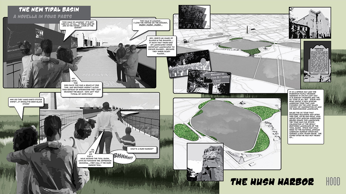
"A Novella in Four Parts"
Hood Design Studio envisions future visitors experiencing the Tidal Basin from an elevated, circular walkway. A "Hush Harbor" trail and bridge along the wetlands will be an educational experience commemorating how indigenous people interacted with the wetlands and how enslaved people would use wetlands as secret meeting places or escape routes.
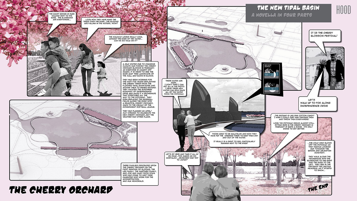
"Intentional flooding" would turn the memorials into a "necklace" of memorial islands that would be toured by boat, and "floating wetlands" that absorb the tides will be visible from a deck at the back of the Jefferson Memorial. The cherry trees would be relocated to a grove at higher ground behind the FDR Memorial taking up a lane of Independence Avenue; these would then be viewable from a new "Kunst Bridge".
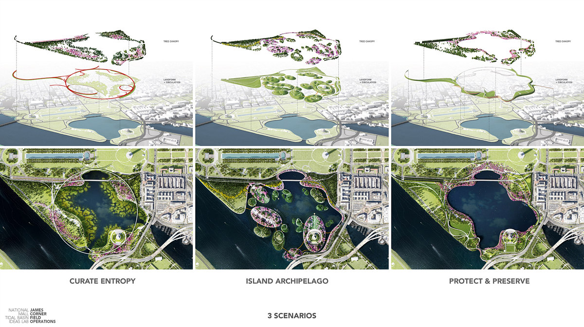
Three Concepts
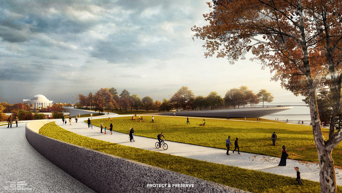
This proposal from James Corner Field Operations imagines three different scenarios or approaches: "protect & preserve", "curate entropy", and "island archipelago". In the preservation scenario, an undulating "earthwork levee" around the Basin would double as activated space with pathways, promontories, and amphitheaters, and an elevated visitor's center would overlook the Basin.
The other two concepts embrace the failing floodgates: in the entropy scenario, an "elevated circular walk" would enable people to enjoy the Tidal Basin even as it continues flooding daily, and memorials and monuments would be allowed to decay. The island archipelago scenario envisions the Potomac River fully flooding the Basin, and the resulting memorial islands as gardens.
Save the Tidal Basin is a partnership between the National Trust for Historic Preservation, the Trust for the National Mall, and the National Park Service, and Skidmore, Owings & Merrill is a partner on Ideas Lab. There is no competition associated with the concepts, but the organization is collecting public feedback.
Similar Posts:
- DC Agency May Restrict Construction in Areas That May Eventually Be Underwater
- Rowing Machines and a Sky Deck: More Details Emerge About Georgetown Canal Redevelopment
- A New Flood Wall Proposed in Georgetown
- The DC Neighborhoods At Risk of Flooding As Early As Next Year
- Underwater Innings: New Software Shows Where Rising Sea Levels Would Impact DC
- The Effect That Chronic Flooding May Have on the DC Area by 2100
- Is DC Prepared For a 500-Year Storm?
See other articles related to: exhibits, flood mitigation, flood risk, flooding, flooding in dc, floodplain, landscape architecture, memorials, monuments, national mall, rising sea levels, sea levels, the mall, tidal basin
This article originally published at https://dc.urbanturf.com/articles/blog/five-design-concepts-for-how-to-save-the-tidal-basin-from-flooding/17433.


UrbanTurf Listings showcases the DC metro area's best properties available for sale.

Most Popular... This Week • Last 30 Days • Ever

UrbanTurf is re-running its primer on property taxes which outlines a few things that... read »
The wait for Eataly in the DC area has been a long one.... read »
The Arlington County Board signed off on a pair of transformative residential project... read »
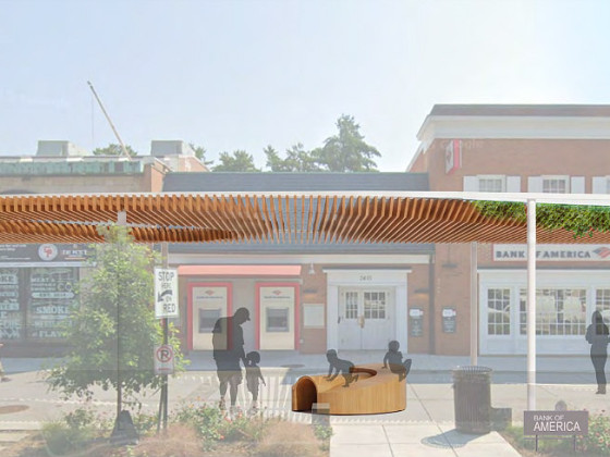
The plan to add a shade structure along the Cleveland Park commercial corridor has re... read »
DOGE doesn't seem dead yet; Monument buys Inn of Rosslyn; and Costco gas stations are... read »


DC Real Estate Guides
Short guides to navigating the DC-area real estate market
We've collected all our helpful guides for buying, selling and renting in and around Washington, DC in one place. Start browsing below!
First-Timer Primers
Intro guides for first-time home buyers
Unique Spaces
Awesome and unusual real estate from across the DC Metro