 A New Tool Tracks Development in Downtown Bethesda
✉️ Want to forward this article? Click here.
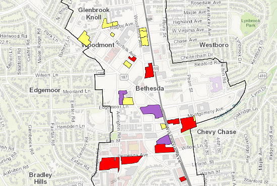
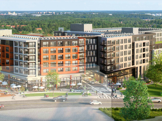
A lot of development is planned or under construction in downtown Bethesda — especially in the wake of a new sector plan allowing additional density in the locality. Now, a new tool can help you keep up with what is going up.
On Monday, the Montgomery County Planning Board introduced an online interactive mapping and tracking tool that outlines the plans for and status of various developments throughout Bethesda. The tool helps users visualize how much bonus Bethesda Overlay Zone (BOZ) density, which developers can tap to enlarge projects in exchange for other commitments, has been used and is available going forward.
story continues below
loading...story continues above
Users will be able to track development at the Sketch Plan, Preliminary Plan and Site Plan phases and get such information as the proposed square footage and land use, number of market-rate and moderately-priced dwelling units, and requested and approved amounts of BOZ density. Users will also be able to download information in spreadsheet format and get links to applicant presentations.
See other articles related to: bethesda, development, downtown bethesda, montgomery county, montgomery county planning board
This article originally published at https://dc.urbanturf.com/articles/blog/new-tool-unveiled-to-track-development-in-downtown-bethesda/13776.


UrbanTurf Listings showcases the DC metro area's best properties available for sale.

Most Popular... This Week • Last 30 Days • Ever
EYA and the Washington Metropolitan Area Transit Authority have requested a two-year ... read »

While the broader DC-area housing market grapples with elevated mortgage rates and ca... read »

From the Maryland line down to the edge of downtown, a mix of office conversions, inf... read »

Bloomberg reported this week that Apple is preparing its biggest-ever push into the s... read »

Close-in suburbs are seeing some of the steepest rent declines in the region, while s... read »


- Rising Costs Stall 434-Unit Takoma Metro Project, Developer Seeks More Time
- The DC-Area Luxury Market Is Playing By Its Own Rules
- 1,800 Units In The Works: Connecticut Avenue's Building Boom
- Apple Is Building a Control Panel for Your Home
- Across The DC Region, Rent Growth Is Splitting Along The Beltway
DC Real Estate Guides
Short guides to navigating the DC-area real estate market
We've collected all our helpful guides for buying, selling and renting in and around Washington, DC in one place. Start browsing below!
First-Timer Primers
Intro guides for first-time home buyers
Unique Spaces
Awesome and unusual real estate from across the DC Metro