 300 MPH, 18 Million Riders: How the Maglev Might Impact Traffic and Transit in the DC Area
✉️ Want to forward this article? Click here.
UPDATE: Since publication, the DC Office of Planning (OP) has released a statement as a prelude to its review of the draft EIS, reiterating its previous concerns and enumerating what their office will focus on in its reading and subsequent submission of comments. "The proposed station in Mount Vernon Square and alignment underneath New York Avenue would change the urban environment and have substantial construction and long-term operational implications on nearby properties," the statement explains. "We encourage the broad range of stakeholders who could be impacted by this project including residents, Advisory Neighborhood Commissioners, Councilmembers, nearby businesses, and business improvement districts to review the DEIS to ensure there are not lasting negative consequences on Mount Vernon Square and the District."
The Federal Railroad Administration and Maryland Department of Transportation-Maryland Transit Administration recently released an environmental impact statement (EIS) for the proposed maglev train that would shuttle passengers between DC and Baltimore in 15 minutes. Based on plans and projections, here's how the project would change traffic and transit in 25 years.
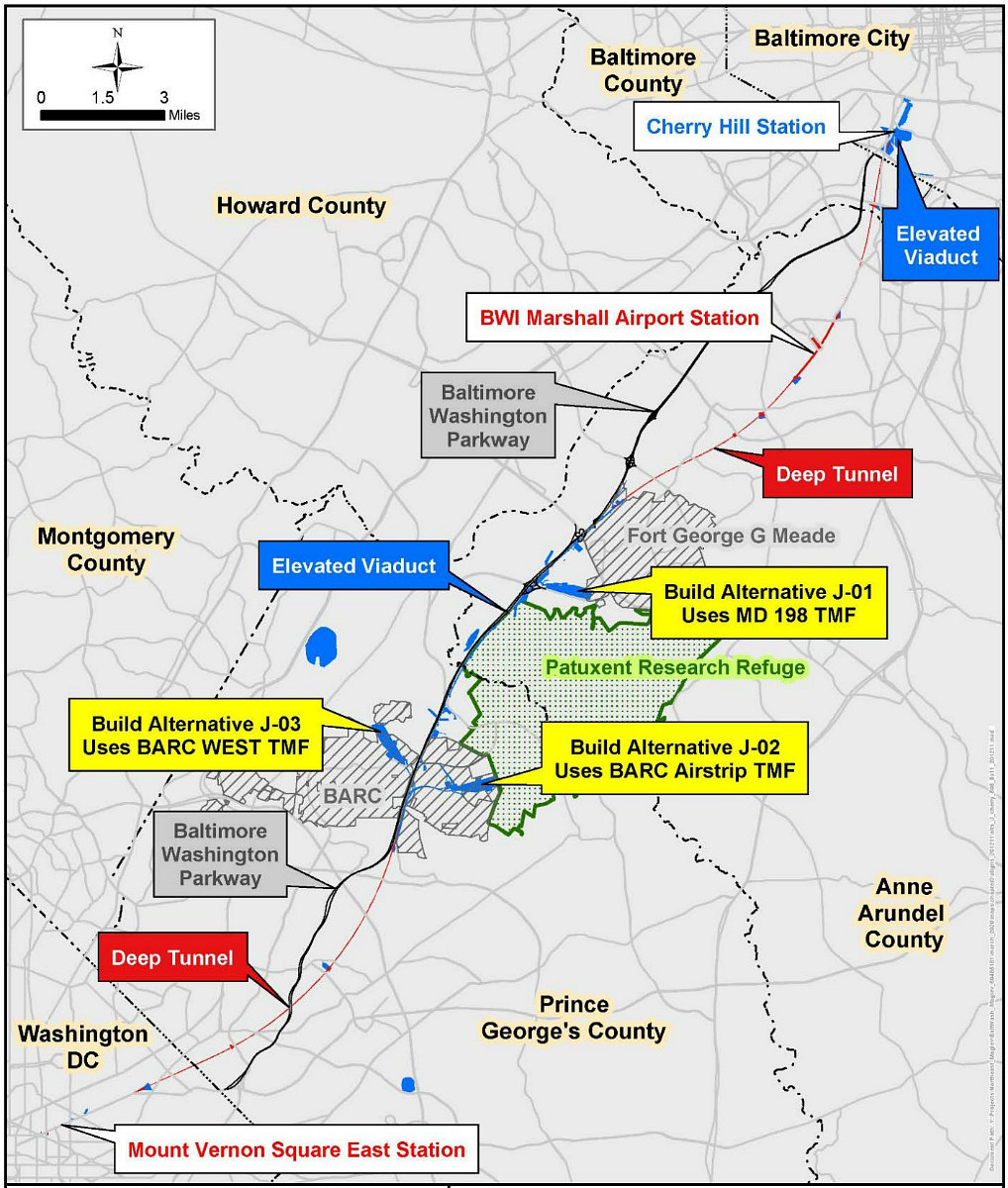
How the Maglev Would Run
The preferred route of project sponsor Baltimore-Washington Rapid Rail (BWRR) is the J-03 option above. This route would originate near Mount Vernon Square Metro station in DC, run below New York Avenue into Maryland and alongside the Baltimore-Washington Parkway both below- and above-grade, stop beneath the current site of BWI Airport's hourly parking garage, then terminate above the MTA light rail station in Cherry Hill (map).
Trains would run seven days a week from 5am to 11pm, on an every 8 minute schedule during peak hours and every 15 minutes during off-peak hours. Each train would have 16 cars and would have a capacity of roughly 543 riders, traveling at an optimum speed of 311 mph.
story continues below
loading...story continues above
A ticket would not be cheap: A trip would cost "roughly seven times" what it now costs to catch the MARC train from Union Station in DC to Penn Station in Baltimore ($8).
18 Million Riders
Assuming the maglev opens in 2030, anywhere from 16.1 to 17.9 million riders are projected to use it in its inaugural year. Ridership could increase to nearly 18.7 million by 2045 if the Cherry Hill station location is selected (if Camden Yards is selected, 2045 ridership is projected at 20.6 million). It is expected that the maglev will poach roughly 32% of annual MARC riders on the Penn and Camden lines (over 2.4 million riders) and 94% of annual Amtrak riders between Penn and Union Stations (over 332,000 riders).
In 2045, the maglev would have 77,764 daily riders, and over the course of the year would divert nearly 14.9 million would-be drivers (up to 57,000 daily vehicular trips), nearly 310,000 bus riders, and over 860,000 cab and rideshare users. Another 3.7 million maglev riders would take the trip just because they're enticed by the service.
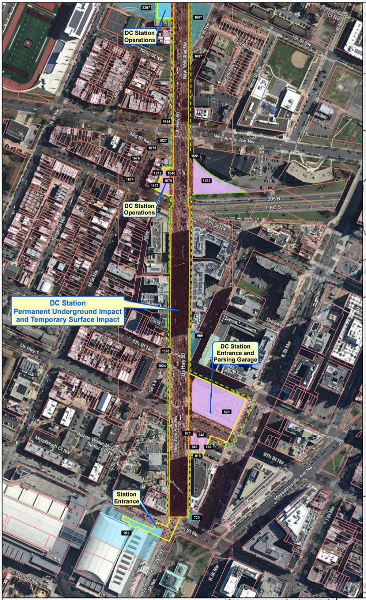
The Mount Vernon Square East station in DC will be accessible on the northeast corner of 4th Street and New York Avenue NW (map), on the southeast corner of 6th Street and New York Avenue NW (map), and on the northwest corner of First Street and New York Avenue NW (map).
Baltimore-Washington Rapid Rail (BWRR) would acquire the parking lots in the 500 block of New York Avenue NW and on the west side of 6th Street to create the Mount Vernon Square East Station Headhouse and Parking Garage.
BWRR would provide 1,000 parking spaces at the station across five below-grade levels, along with a pick-up/drop-off area on the first below-grade level — but another 3,360 daily riders are expected to also need to find somewhere to park their cars.
Potential Locations for Ancillary Structures
Among the eight "fresh air and emergency egress sites" (FA/EE) necessary along the maglev route, one is expected to displace the Adam's Place Emergency Shelter off New York Avenue and Bladensburg Road NE (map), and another may necessitate acquisition of four houses on Riverdale Road. These sites would be single buildings 40-50 feet tall above a vertical air structure and would include an elevator to permit access to the tunnel for maintenance and emergencies.
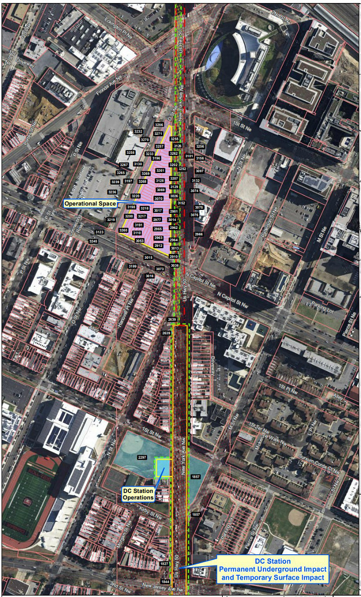
BWRR would also have to purchase the surface parking lot that seemingly includes Douglas Development's recently-proposed project between North Capitol and O Streets and New York Avenue NE (map). The Pepco substation on Harry Thomas Way NE (map) may also be expanded.
While there will be several small construction sites along the route as needed, a few large sites have already been identified for storage of precasted components of the system: the 40-acre former Landover Mall site (map); a 160-acre, undeveloped site near where I-95 and MD Route 200 interchange in Laurel (map); and the 50-acre former Suburban Airport site in Anne Arundel County (map).
Construction of the DC-to-Baltimore line is now estimated to take about seven years after all approvals are secured. The public can submit comments on the draft EIS through April 22nd.
See other articles related to: baltimore, dc's 15-minute train, maglev, new york avenue, northeast maglev
This article originally published at https://dc.urbanturf.com/articles/blog/how-the-maglev-might-impact-traffic-and-transit-by-2045/17767.


UrbanTurf Listings showcases the DC metro area's best properties available for sale.

Most Popular... This Week • Last 30 Days • Ever

UrbanTurf is re-running its primer on property taxes which outlines a few things that... read »

The wait for Eataly in the DC area has been a long one.... read »
The Arlington County Board signed off on a pair of transformative residential project... read »
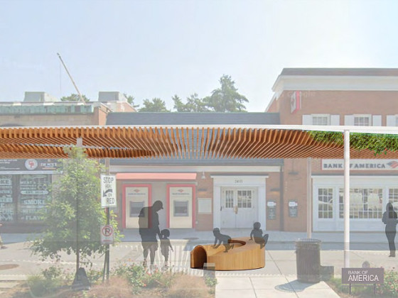
The plan to add a shade structure along the Cleveland Park commercial corridor has re... read »

DOGE doesn't seem dead yet; Monument buys Inn of Rosslyn; and Costco gas stations are... read »


DC Real Estate Guides
Short guides to navigating the DC-area real estate market
We've collected all our helpful guides for buying, selling and renting in and around Washington, DC in one place. Start browsing below!
First-Timer Primers
Intro guides for first-time home buyers
Unique Spaces
Awesome and unusual real estate from across the DC Metro