 National Landing BID Reimagines Route 1
✉️ Want to forward this article? Click here.
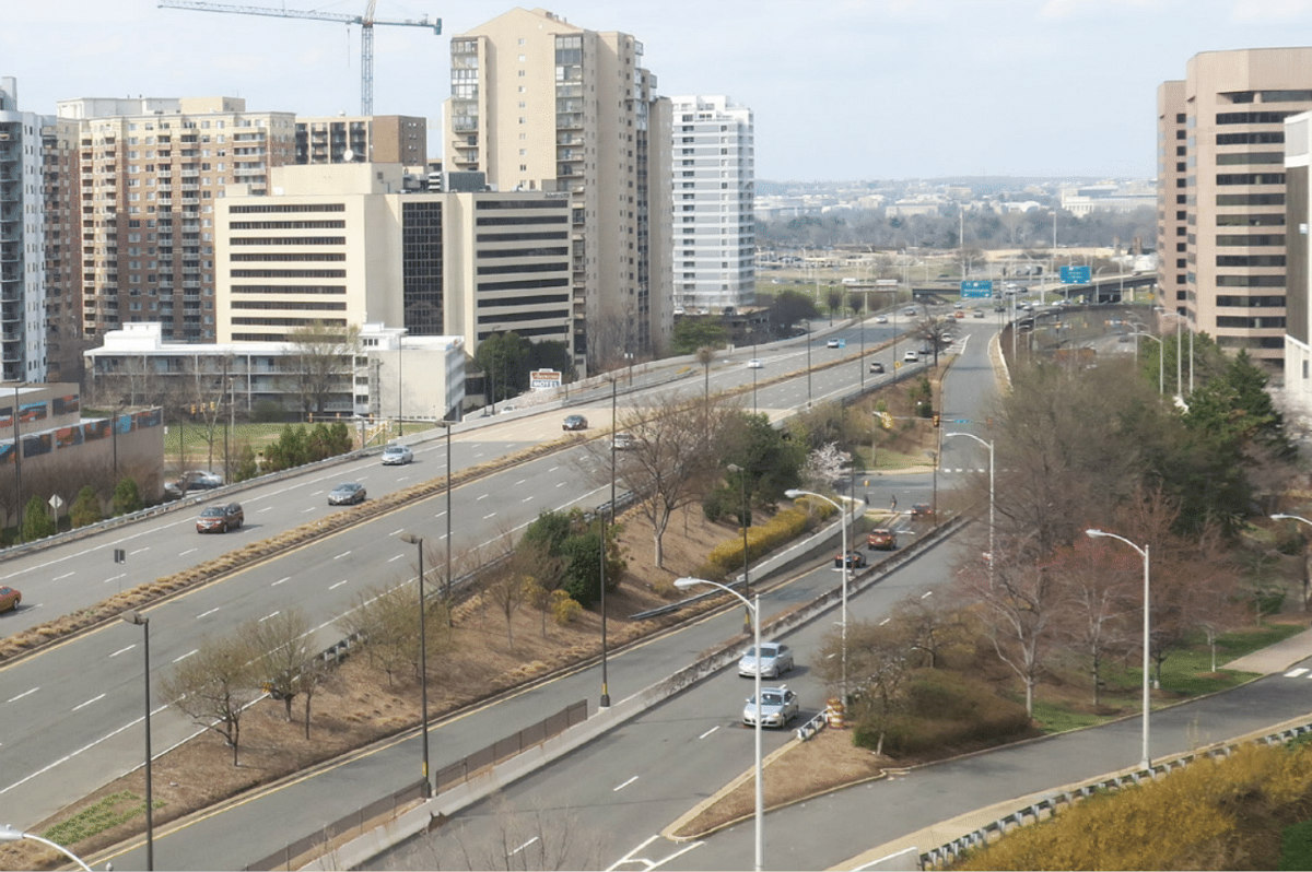
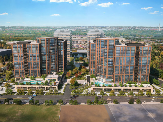
A reconfiguration of Route 1 in Arlington has been up for discussion for more than a decade. Now, the recently-rebranded National Landing Business Improvement District (BID) is putting forth a proposal for how that remaking could take shape.
The BID released its Reimagining Route 1 report today, offering three concepts for how to de-center vehicular transportation along the six-lane highway between just north of 15th Street S and South Glebe Road. The proposal aims to turn Richmond Highway into more of a "Main Street" that "prioritizes people, not cars".
story continues below
loading...story continues above
"Today’s Route 1 configuration creates a physical and psychological barrier separating Crystal City and Potomac Yard to the east and PentagonCity and Aurora Highlands to the west," the report explains. "High speeds, wide lanes, restrictive pedestrian signal timing, lack of sidewalks, and poor urban design all contribute to the poor connectivity for all modes of transportation including vehicles, bicycles, and pedestrians along the entire corridor between Alexandria to the south and 12th Street to the north."
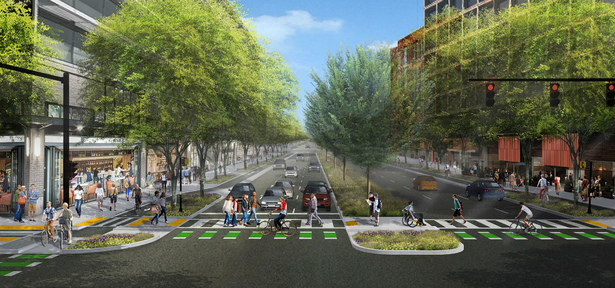
The three concepts would employ best practices such as wider sidewalks buffered by landscaping, infrastructure for multimodal transportation (eg. Light Individual Transit (LIT) lanes for cycling and scooters, bus lanes, and pick-up/drop-off areas), public art, outdoor furniture, and stormwater runoff.
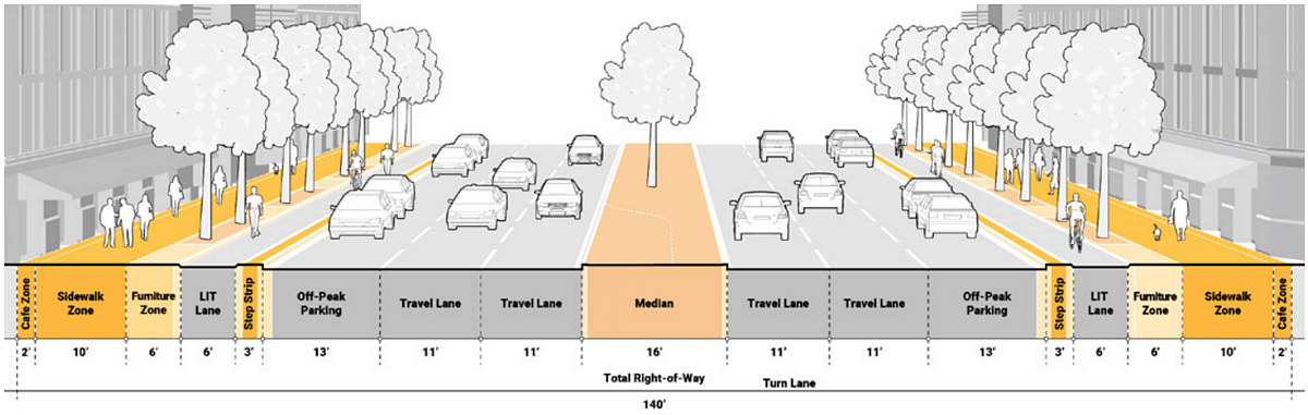
The first concept is for the Green Median Boulevard, which would have a median that could serve as a left turn lane in some areas. This concept would have the narrowest LIT buffer space and would maintain six lanes of traffic (three in either direction), with the far lanes used for parking during off-peak hours.
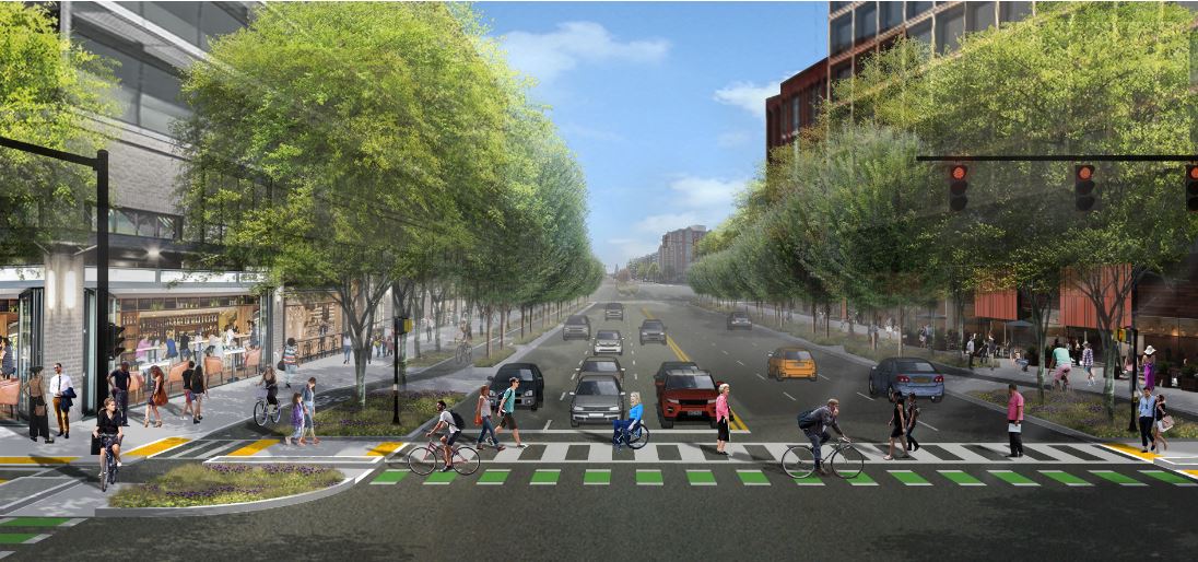
The second concept, for the Maximum Sidewalk Boulevard, is relatively self-explanatory, offering space for retail and restaurants to put merchandise or seating outside. This concept would work well in tandem with corner plazas outside buildings along the street, but there would be no median for traffic calming or pedestrian respite. This option would also maintain six lanes of traffic (three in either direction), with the far lanes used for parking during off-peak hours.
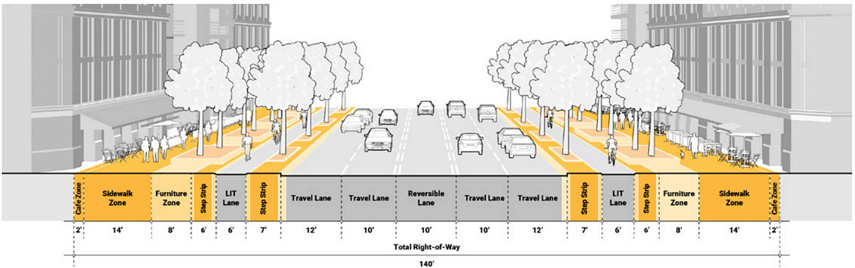
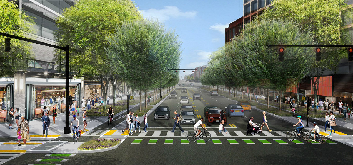
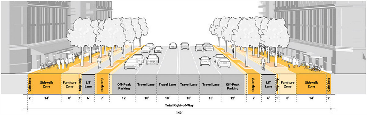
The third concept, the Flexible Boulevard, would create five lanes of traffic with a reversible middle lane that could also be used for left turns during off-peak hours. This option would remove any street parking, would also forgo a median, and would create floating bus stops separated from the sidewalk by the LIT lanes.
The BID's concepts would also implement such measures like speed and red light cameras, bicycle parking corrals, bikeshare stations, and an "all-walk phase" where all pedestrians could move freely through intersections at one time.
Changes were initially recommended for the corridor in the Crystal City Sector Plan, passed by the Arlington County Board in 2010. The Virginia Department of Transportation (VDOT) also recently launched a study for possible improvements to the Route 1 corridor. The BID's report is intended as a starting point for stakeholders along Route 1 and to give input to VDOT.
All images courtesy of the National Landing BID.
See other articles related to: arlington, arlington county, crystal city, national landing, national landing bid, pentagon city, richmond highway, route 1, virginia, virginia department of transportation
This article originally published at https://dc.urbanturf.com/articles/blog/national-landing-bid-reimagines-route-1-corridor/17377.


UrbanTurf Listings showcases the DC metro area's best properties available for sale.

Most Popular... This Week • Last 30 Days • Ever

UrbanTurf is re-running its primer on property taxes which outlines a few things that... read »
The wait for Eataly in the DC area has been a long one.... read »
The Arlington County Board signed off on a pair of transformative residential project... read »
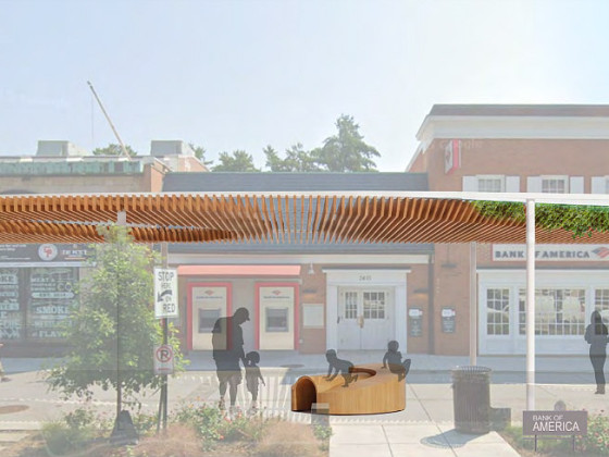
The plan to add a shade structure along the Cleveland Park commercial corridor has re... read »
DOGE doesn't seem dead yet; Monument buys Inn of Rosslyn; and Costco gas stations are... read »


DC Real Estate Guides
Short guides to navigating the DC-area real estate market
We've collected all our helpful guides for buying, selling and renting in and around Washington, DC in one place. Start browsing below!
First-Timer Primers
Intro guides for first-time home buyers
Unique Spaces
Awesome and unusual real estate from across the DC Metro