What's Hot: Did January Mark The Bottom For The DC-Area Housing Market? | The Roller Coaster Development Scene In Tenleytown and AU Park
 Drawing the Line: Georgetown
✉️ Want to forward this article? Click here.
The exact boundaries of DC neighborhoods are a hotly debated topic, particularly amongst long-time residents who resist any re-interpretation that cuts their hood short by even one block.
For homebuyers, the boundary issue can be particularly crucial. With the exact borders of a neighborhood often in question, buyers can be left thinking that they’re looking at property in one neighborhood when it is technically in another. Drawing The Line will discuss the boundaries of various DC neighborhoods, the restoration societies that govern them, and the issues that can arise as a result of a regular misinterpretation of the borders. Today, we look at Georgetown.
See all our past Drawing the Line features here.
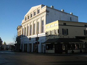
Wisconsin Avenue by Jim Malone.
Georgetown is one of the few areas in DC with a name that is known by people throughout the country. It is also one of a handful of neighborhoods in the District that has boundaries dictated by federal statute, and the only part of the city that existed as a separate municipality prior to its inclusion in 1871. Georgetown’s culture, architecture, and history are protected by the Old Georgetown Board, which administers permits authorizing various additions and alterations to neighborhood real estate. Understanding where Georgetown begins and ends, and what the Board pays close attention to, is valuable information for buyers.
The Old Georgetown Act (Public Law 81-808, Congress H.R. 7670 passed on September 22, 1950) says that “Old Georgetown” is “bounded on the east by Rock Creek and Potomac Parkway from the Potomac River to the north boundary of Dumbarton Oaks Park, on the north by the north boundary of Dumbarton Oaks Park, Whitehaven Street and Whitehaven Parkway to 35th Street, south along the middle of Thirty-fifth Street to Reservoir Road, west along the middle of Reservoir Road to Archbold Parkway, on the west by Archbold Parkway from Reservoir Road to the Potomac River, on the south by the Potomac River to the Rock Creek Parkway.” Those borders look like this:
The Act gives jurisdiction to the United States Commission on Fine Arts for reviews related to new buildings or large projects in the neighborhood, such as the recently opened Apple Store, which was a bone of contention among historic preservationists long before it ever started selling MacBooks to Georgetown University freshmen. The Commission provides guidance on the height, color, design, and exterior appearance of private buildings in certain areas of the District and reviews permits for the construction, alteration, reconstruction, or razing of any buildings in Old Georgetown.
Submissions of applications for substantial changes to a property are due three weeks prior to the Old Georgetown Board meeting on the first Thursday of every month. The recommendations by the Board are sent to the Commission on Fine Arts for approval and then entered into the public record. Because Georgetown is such a historically rich area, prospective homeowners in the area should make themselves aware of the guidelines that govern historic preservation in the neighborhood. As with all neighborhoods of historic designation, reading the bylaws is a worthwhile use of time for anyone in the market for a property that they plan to eventually renovate or add to.
Unlike neighborhoods such as Dupont Circle and Columbia Heights where exact boundaries seem to shift a couple blocks depending on whom you ask, Georgetown’s street boundaries have remained fairly firm over the years. Perhaps the only issue that arises from time to time is on the northwestern border of the neighborhood where sections of Burleith are frequently mistaken for being a part of Georgetown. Neighbors to the east (West End and Foggy Bottom) and west (Foxhall and The Palisades) are rarely confused with the historic DC hood.
See other articles related to: drawing the line, georgetown
This article originally published at https://dc.urbanturf.com/articles/blog/drawing_the_line_georgetown/2417.
Most Popular... This Week • Last 30 Days • Ever

Rocket Companies is taking a page from the Super Bowl advertising playbook with a spl... read »
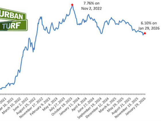
As mortgage rates have more than doubled from their historic lows over the last coupl... read »

The small handful of projects in the pipeline are either moving full steam ahead, get... read »

The longtime political strategist and pollster who has advised everyone from Presiden... read »

Column critique for Commanders stadium; more love for Eebees; and why just building m... read »
DC Real Estate Guides
Short guides to navigating the DC-area real estate market
We've collected all our helpful guides for buying, selling and renting in and around Washington, DC in one place. Start browsing below!
First-Timer Primers
Intro guides for first-time home buyers
Unique Spaces
Awesome and unusual real estate from across the DC Metro


