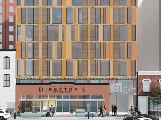
What's Hot: The 4 Projects in the Works Near DC's Starburst Intersection | A 153-Room Aloft Hotel Pitched For Mt. Vernon Triangle
 What Would DC Look Like With Tall Buildings?
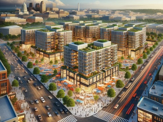
On Wednesday morning, the National Capitol Planning Commission and the Office of Planning launched Phase 2 of the Height Master Plan study for Washington, DC, which included the results of an economic feasibility analysis and an extensive visual mapping exercise.
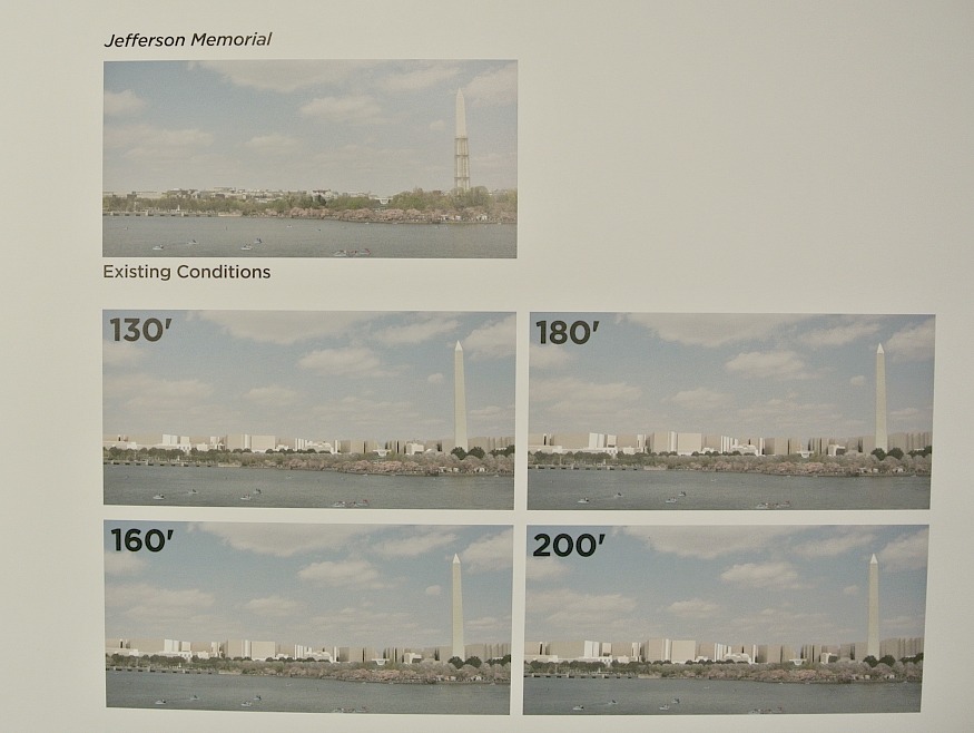
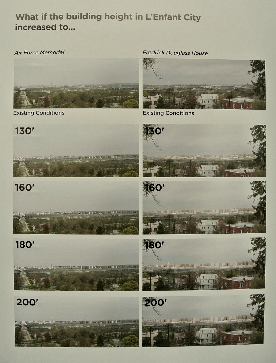
Over the last few months, a team led by design, architecture and engineering firm Skidmore, Owings and Merrill has been at work creating images of what DC would look like with taller buildings. In the images, federal properties, historic sites, low density historic districts and all low density areas were kept at their current heights.
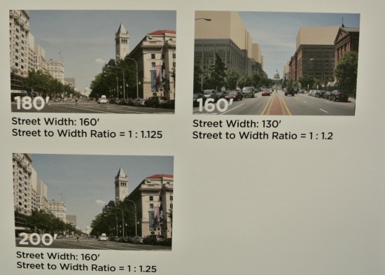
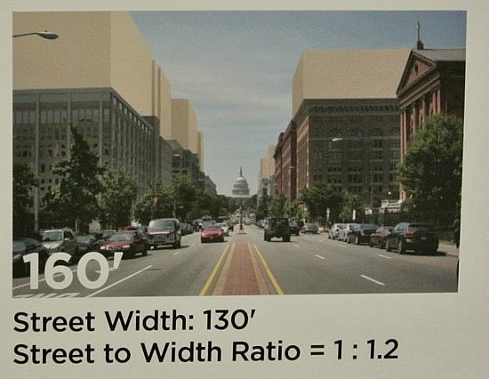
From there, the team, which also includes CyberCity 3D, Digital Design and Imagining Service, AMT, LLC Consulting Engineers and Land Surveyers and Capital Pixel (who contributes our “Re-Imagined” feature), concentrated on a few different potential outcomes: building up to the currently allowable height limit (particularly making the rooftops and penthouses more useful), rethinking the relationship between street width and building height (for example, increasing the building:street ratio on Pennsylvania Avenue from .7:1 to 1.2:1), increasing heights in selected areas throughout the city, and (dramatic pause) increasing heights everywhere.
As for increasing the heights in selected areas, the team looked at several scenarios, from choosing a dozen discrete clusters throughout the city wherein to lift the height limits, to making buildings taller along the edge of the “topographic bowl,” just outside of L’Enfant City.
If buildings along North Capitol Street were increased to 160 feet.
The images presented today range from far-out skyline views to street-level sights. The images that elicited the biggest responses were either skyline views that showed a quickly disappearing Capitol Dome or White House, or street level views that closed in on the current view shed towards the Capitol, making it much less prominent.
“I was, like so many of you, horrified by some of the images I saw,” said Mina Wright of the GSA. “However, cities are not museums. We cannot let history put a choke hold on growth and dynamism.”
All of the images will be available on NCPC’s website by August 3rd, so city residents will have a chance to sift through them at their leisure. Residents will have a chance to give feedback on the plans at any of five public meetings planned throughout the city during the coming months.
A few images were available to view at the meeting on Wednesday, and we snapped some photos. For those hoping for a futuristic look at DC, you may be out of luck: the designers made all of the new buildings and additions windowless, sandy colored blocks, simply to get a sense of the changing views and feel.
See other articles related to: dc height act, height act
This article originally published at https://dc.urbanturf.com/articles/blog/what_would_dc_look_like_with_tall_buildings_a_few_images/7366.


UrbanTurf Listings showcases the DC metro area's best properties available for sale.
Most Popular... This Week • Last 30 Days • Ever

In this article, UrbanTurf looks at the estimated annual maintenance costs associated... read »
Another concept has been unveiled for one of DC's most contentious development sites,... read »
Renter demand has continued to push Class A apartment rents in the DC region up this ... read »
The big news in the development pipeline east of DC's H Street Corridor is the resur... read »
A new hotel has been pitched for a development site in Mount Vernon Triangle that has... read »


DC Real Estate Guides
Short guides to navigating the DC-area real estate market
We've collected all our helpful guides for buying, selling and renting in and around Washington, DC in one place. Start browsing below!
First-Timer Primers
Intro guides for first-time home buyers
Unique Spaces
Awesome and unusual real estate from across the DC Metro