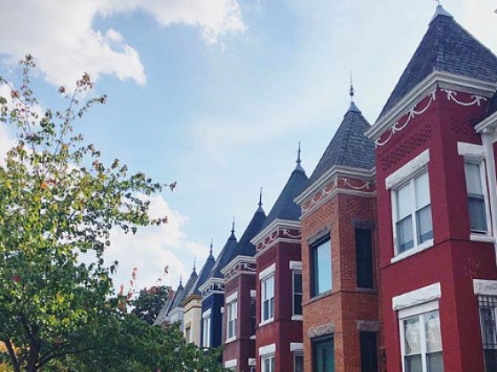
 Three Definitions of "Gentrification" Apply to Seven DC Census Tracts
There have been several studies outlining the magnitude of gentrification and displacement over the past few months, with some concluding that DC is one of the most heavily-gentrified cities in the country. Far less consistent across these studies was a definition of gentrification.
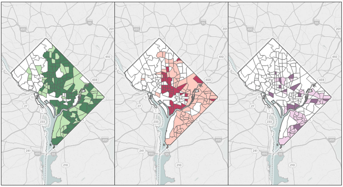
Now, Enterprise Community Partners has released a tool which compares gentrification data for over 90 cities based on three different definitions of gentrification. The definitions, adapted from three well-known studies, were applied to census tract data from 1970-2010. Census tracts were then categorized as either gentrified, eligible (due to low-income and disinvestment) but not gentrified (essentially remaining low-income over the decade), and not eligible (due to higher income).
The first measure, from the 2005 Freeman study, considers a tract "eligible" if both the median household income and share of housing constructed in the 20 years prior are less than the values in the first year of the pertinent decade. By this measure, the tract is gentrified if it qualified as eligible, the share of residents in the tract with a college degree grew more than the metro-wide value, and housing prices increased from the beginning to the end of the decade.
The second measure, from the 2008 Ellen and O'Regan study, considers a tract "eligible" if the ratio of average household income between the tract and the metro area is less than 0.7 at the beginning of the decade. By this measure, the tract is gentrified if it qualified as eligible and there was at least a 10 percentage-point increase in the ratio over the decade.
The third measure, from the 2010 McKinnish et. al study, considers a tract "eligible" if the average family income is in the bottom 20 percent of all urban census tracts nationwide in the first year of the decade. By this measure, the tract is gentrified if it qualified as eligible and the average family income increased by at least $10,000 from the beginning to the end of the decade.
Across these maps, there are only seven DC census tracts which are consistently identified as gentrified from 2000 to 2010:
- Tract 7200, southeast of 695 and South Capitol Street SE to the Anacostia River;
- Tract 2801, from 14th to 16th Street between Spring Road and Newton Street NW;
- Tract 7100, southeast of Pennsylvania Avenue and 11th Street to the Anacostia River SE;
- Tract 4901, between 7th and 11th Street from M to Q Streets NW;
- Tract 9903, southwest of East Capitol Street and Southern Avenue SE, north of Central Avenue;
- Tract 4701, northwest of K Street and North Capitol, south of New York Avenue NW; and
- Tract 7901, between Benning Road and C Street NE from 15th to 19th Street.
See other articles related to: gentrification
This article originally published at https://dc.urbanturf.com/articles/blog/three-definitions-of-gentrification-all-apply-to-seven-dc-census-tracts/15390.


UrbanTurf Listings showcases the DC metro area's best properties available for sale.
Most Popular... This Week • Last 30 Days • Ever

Plans for the development at a prominent DC intersection began nearly eight years ago... read »

DC's homebuyer assistance programs can be a bit complex. This edition of First-Timer ... read »
DC and Virginia lead the way in terms of where prices have risen the most this year.... read »
When it comes to financing a home purchase, a 30-year mortgage is one of the most com... read »
Pocket listings are growing in popularity in the low-inventory market in the DC regio... read »


DC Real Estate Guides
Short guides to navigating the DC-area real estate market
We've collected all our helpful guides for buying, selling and renting in and around Washington, DC in one place. Start browsing below!
First-Timer Primers
Intro guides for first-time home buyers
Unique Spaces
Awesome and unusual real estate from across the DC Metro